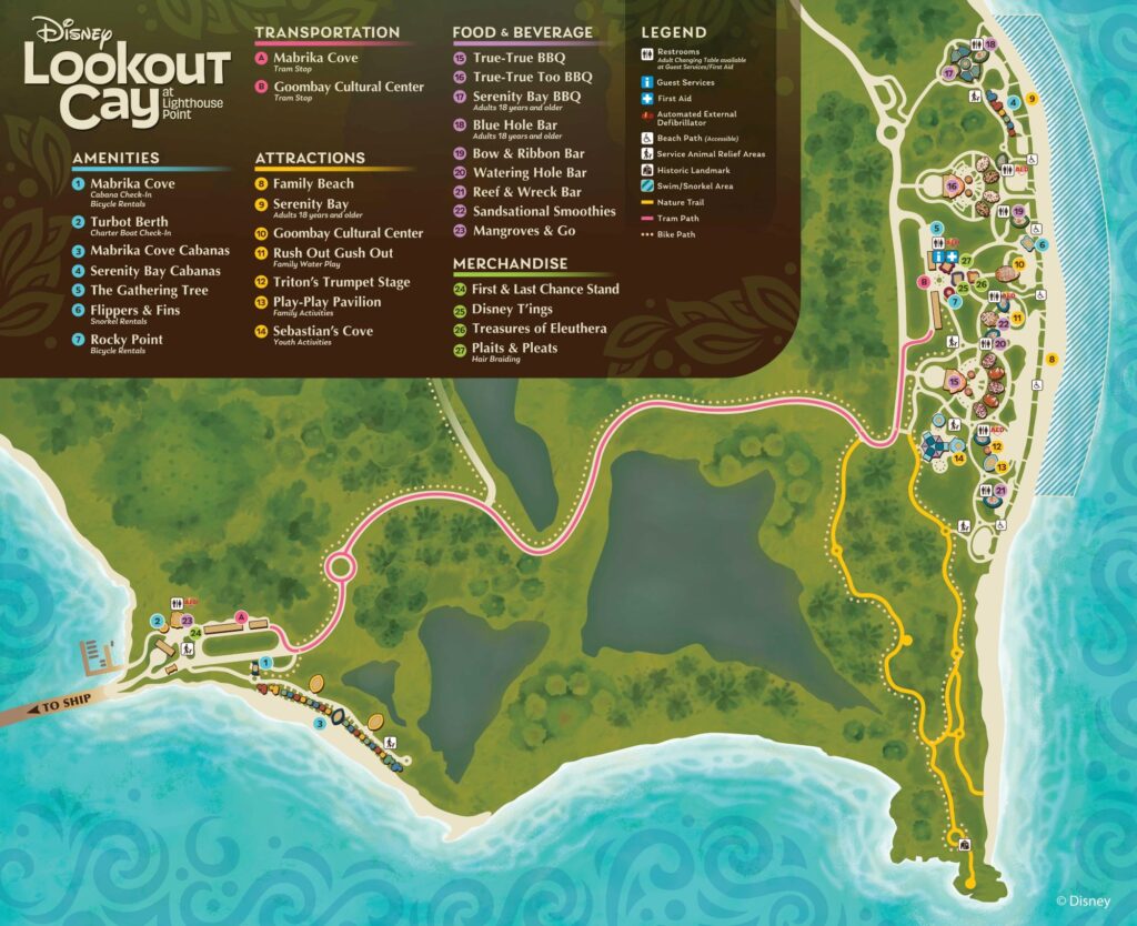
Disney has released the first map for Disney Cruise Line’s newest tropical destination Lookout Cay at Lighthouse Point. The map shows where the cabanas, restaurants, merchandise, and swimming areas are located at this new Disney cruise stop.
Click the map on desktops for a larger version.

For reference, guests will enter Lookout Cay on the far left side of the map. The Disney ship will be parked at a dock just to the west of what the map is showing. Then, the majority of guests will take trams over to the eastern side of the island where the bulk of amenities are located. That side faces away from where the cruise ships will be parked, which means most guests won’t be able to enjoy picturesque views with a Disney cruise ship in the background.
We can also see that the Mabrika Cove Cabanas are located near the dock, and are not near any of the three BBQ locations. Does Disney have a plan on how to get the usually-delicious BBQ lunches to these guests, or will guests have to take a tram over to the other side of the island for lunch?
It’s also worth recognizing that the only swim and snorkel area designated on the map is on the eastern side near the Family Beach and Serenity Bay.
This map of Disney Lookout Cay reaffirms that this new island destination is aiming to look and feel similar to Castaway Cay. Disney is planning some unique entertainment at Lookout Cay, but they’re not planning anything extravagant (like a water park at Royal Caribbean’s CocoCay) at this time.
Will Lookout Cay at Lighthouse Point live up to the high bar set by Castaway Cay? Should Disney have tried something different at this tropical cruise stop?


